
Science Olympiad Road Scholar Practice Exam
$69.00
- Buy to unlock unlimited access to all Quiz questions.
- After purchase you can print a PDF of the whole quiz at any point. The PDF will contain the questions and the correct answers.
About this Exam
The Science Olympiad Road Scholar event challenges students to master the principles of cartography, navigation, and spatial analysis. This practice exam is specifically designed to help competitors in Division B and Division C hone the critical thinking skills, speed, and accuracy required for official competition.
This resource targets students looking to build confidence in interpreting multi-layered topographic maps, road atlases, and satellite data. By completing this practice material, students will be better prepared to solve complex spatial problems under pressure, improving both their individual proficiency and their team's overall score.
Ready to test your knowledge?
Buy Now to Access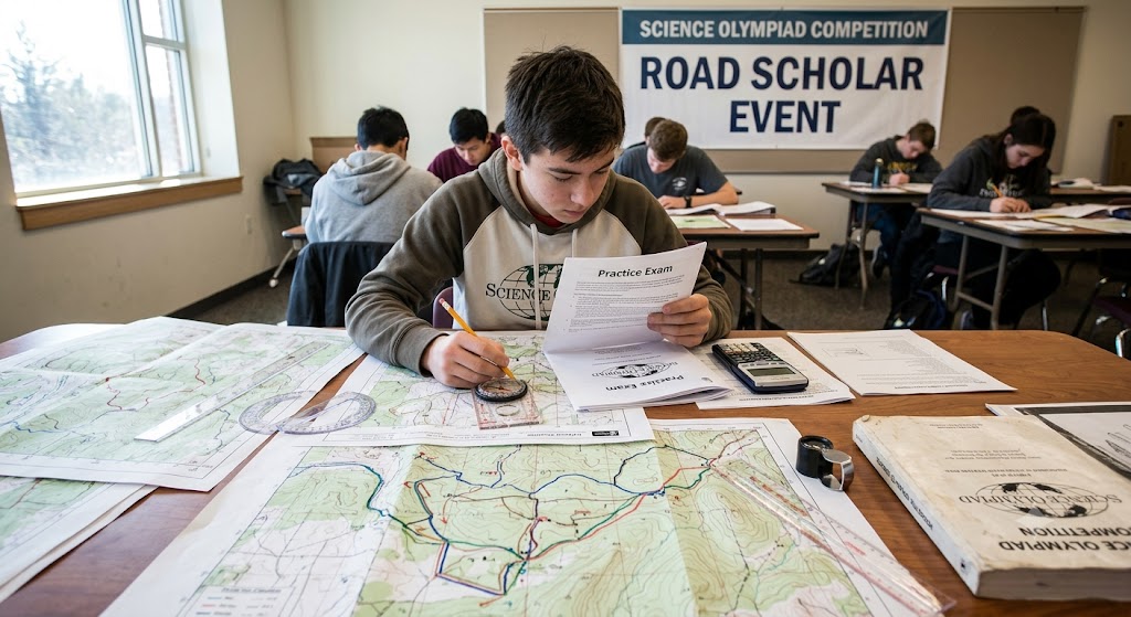
Additional Information
What the Course Entails and Exam Details
The material covered in this practice exam replicates the rigorous scope of the official Road Scholar national syllabus. Key skill areas include, but are not limited to, the following:
Topographic Map Interpretation: Analyzing elevation via contour lines, determining slope, identifying cultural features, and calculating relief.
Coordinate Systems and Projections: Working with latitude and longitude, Universal Transverse Mercator (UTM) grids, and understanding map scale and distortions.
Navigation and Orienteering: Using compass bearings, calculating azimuths, determining true and magnetic north, and plotting efficient routes.
Distance and Measurement: Accurately measuring ground distance, performing map conversions, and utilizing graphic scales.
Data Integration: Cross-referencing information between different types of maps, including road maps, satellite imagery, and state or national park maps.
The practice exam typically combines a written portion, requiring calculation and analysis, with a practical application phase that involves direct interaction with official maps (such as United States Geological Survey topographic sheets).
What to Expect in the Final Exam
While the exact structure of official state and national competitions can vary slightly, this practice exam is built on the standard model for Science Olympiad.
Format: The test is usually divided into multiple, timed stations or a comprehensive paper-based booklet. Questions may range from multiple-choice to short-answer responses requiring calculations, sketching cross-sections, or drawing the correct route on a map provided during the event.
Time Limit: Competition times are strictly enforced, typically lasting around 50 minutes. Speed is a critical component, as the volume of questions is deliberately designed to be challenging.
Scoring: Points are awarded for accuracy and detail. There is no penalty for guessing, so students are encouraged to attempt all questions. Partial credit may be given for work shown in calculations. A perfect score is rarely achieved in top-level competition, reflecting the difficulty.
Materials Allowed: Students should check current official rules, but teams are typically allowed to bring specified reference materials (like a 3-ring binder) and scientific calculators. A compass, ruler, and protractor are essential navigation tools.
How to Study and Exam Centers
Preparation is paramount. Here are actionable study strategies and information on taking the exam:
Study Strategies:
Work with Real Maps: Obtain USGS topographic maps of different scales and terrains. Practice measuring distances, converting scales, and drawing cross-sections until they are second nature.
Master Your Tools: Ensure you can use a baseplate compass fluently, converting magnetic bearings to grid bearings (or vice versa) instantly using the declination diagram provided on a map.
Build Your Reference Binder: Since the event allows reference materials, build a comprehensive, indexed binder containing glossaries of cartographic terms, symbol guides, example calculations for slope and UTM coordinates, and previous practice tests.
Time Yourself: Do not just solve problems; solve them quickly. Take entire sections of practice tests under a timer to simulate the stress of a real competition.
Taking the Exam:
Practice Tests: You can take this practice exam through authorized resources like the official Science Olympiad website, state organization portals, or dedicated coaching forums. These are usually provided in printable PDF formats for simulated 'paper and map' experience.
Official Competitions: Official Science Olympiad invitational, regional, state, and national tournaments occur at certified academic institutions and authorized competition venues (which are listed on official Science Olympiad schedules). These are team-based events.
Job Opportunities from the Course
While Road Scholar is a youth academic event, the spatial reasoning and analytical skills developed are highly valued in numerous technical and environmental fields. Success in this event can be a precursor to careers such as:
Geographic Information Systems (GIS) Technician: Analyzing spatial data and creating digital maps for municipalities, environmental firms, and defense.
Cartographer and Photogrammetrist: Designing and updating maps using satellite and aerial data.
Surveying Technician: Assisting in measuring and mapping the earth's surface for engineering, construction, and property boundaries.
Environmental Scientist: Utilizing mapping technology to track environmental changes, pollution, and wildlife habitats.
Urban and Regional Planner: Applying spatial analysis to plan infrastructure development, transportation networks, and community zoning.
Military Intelligence or Logistics Specialist: Leveraging navigation and geospatial skills for strategic planning and field operations.
Outdoor Recreation Guide and Orienteering Instructor: Applying professional navigation and map reading for adventure tourism and outdoor education.
Frequently Asked Questions
Reviews
5.0
Based on 0 reviews
Leave a Review
No reviews yet. Be the first to review!