
Land Surveyor Practice Test & Exam Prep
$69.00
- Buy to unlock unlimited access to all Quiz questions.
- After purchase you can print a PDF of the whole quiz at any point. The PDF will contain the questions and the correct answers.
About this Exam
Becoming a licensed Land Surveyor is a rigorous, highly respected professional milestone. It validates your expertise in measuring and mapping the Earth's surface, a critical function for construction, development, boundary definition, and legal property descriptions. This comprehensive Land Surveyor Practice Test and Exam Prep is designed specifically for aspiring professionals preparing to sit for their state-specific surveying examinations (such as the NCEES PS exam) or foundational certification tests. This guide serves as your roadmap, helping you understand the rigorous requirements and preparing you with the knowledge and confidence needed to pass. This pathway is ideal for engineering technicians, surveying interns, and graduates with geomatics or surveying degrees who are committed to a career in professional land measurement.
Ready to test your knowledge?
Buy Now to Access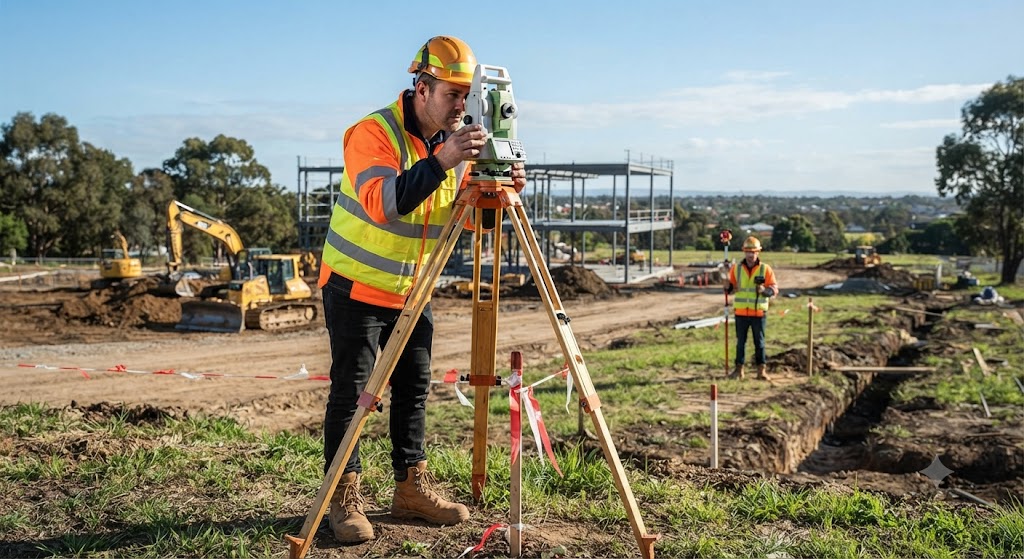
Additional Information
What the Course Entails and Exam Details
To achieve licensure, candidates must master a complex body
of knowledge that blends mathematics, law, technology, and ethics. The
coursework and subsequent exams are structured to test your proficiency in
these core competency areas. A typical curriculum and exam blueprint will cover
the following essential topics:
- Mathematics
and Geodesy: Mastery of advanced algebra, geometry, trigonometry, and
calculus as applied to surveying computations, coordinate systems (like
State Plane and UTM), and map projections.
- Boundary
Law and Legal Principles: Understanding property law, riparian rights,
evidence interpretation, creating land descriptions, adverse possession,
and the legal hierarchy of controlling monuments.
- Surveying
Instruments and Field Procedures: Proficient use of total stations,
GPS/GNSS equipment, levels, and data collectors, along with proper field
note procedures, traversing, and leveling techniques.
- Cartography
and GIS: Principles of drafting, interpreting land surveys, and
integrating survey data into Geographic Information Systems (GIS).
- Business
and Professional Ethics: Understanding the surveyor's ethical
responsibilities, business practices, contracts, and liability.
What to Expect in
the Final Exam
The final examination is the culmination of your preparation
and is designed to rigorously test your ability to apply surveying principles
in real-world scenarios. While specific formats can vary by state or
jurisdiction (often utilizing exams developed by NCEES—National Council of
Examiners for Engineering and Surveying), candidates should generally expect
the following format:
- Exam
Format: The exam is predominantly multiple-choice, often split into
morning and afternoon sessions. However, some advanced state-specific
portions may include complex calculation problems, scenario-based
questions, and ethics essays.
- Time
Limits: This is a timed, proctored examination. Typically, candidates
are given a generous timeframe, such as 6 to 8 hours, to complete the
entire exam, reflecting the complexity and volume of the material.
- Passing
Score: Passing scores are scaled, not raw scores, meaning the required
percentage can fluctuate slightly based on the specific exam version's
difficulty. Generally, a score equivalent to approximately 70% or higher
is required to pass.
- Reference
Materials: These exams are almost always "open book,"
meaning you are permitted to bring NCEES-approved reference materials,
textbooks, and a permitted calculator. The key is knowing how to
find information quickly, not just memorizing it.
How to Study and
Exam Centers
Success on the Land Surveyor Exam requires more than just
reviewing textbooks; it requires structured practice and strategic planning.
- Strategic
Study Methods:
Master the Reference Manuals:
The NCEES Reference Handbook and approved state-specific manuals should be your
primary resources. Become intimately familiar with every formula, table, and
definition they contain.
Take Timed Practice Tests:
This is crucial. Utilize official practice exams from NCEES or reputable
third-party providers to simulate the actual testing environment. Time yourself
to build endurance and improve your speed in locating information.
Focus on Weak Areas: Don't
just keep studying what you know. Analyze your practice test results and
dedicate the most time to subjects where you consistently struggle (e.g.,
Public Land Survey System (PLSS) or complex boundary law).
Form Study Groups:
Collaborate with other candidates. Explaining complex surveying problems to
others is one of the most effective ways to solidify your own understanding.
- Exam
Centers and Registration: The primary surveying exams (Fundamentals of
Surveying - FS, and Professional Surveying - PS) are administered
year-round at authorized Pearson VUE testing centers located globally.
Before you can schedule your exam, you must first complete the
registration and approval process with your specific state's Board of Licensure
for Professional Surveyors. Once approved, you will receive an
Authorization to Test (ATT) and can select a testing location and date
that works best for you.
Job Opportunities
from the Course
Passing the Land Surveyor Exam and becoming a licensed
Professional Surveyor (PS) opens the door to a wide array of stable, lucrative,
and respected career paths across various sectors:
- Licensed
Professional Land Surveyor (PLS): The primary goal. You can stamp and
sign surveys, act as an expert witness, and operate your own surveying
firm.
- Survey
Manager/Director: Leading teams of field crews and office technicians
on large-scale projects.
- Geospatial
Data Analyst: Using advanced technology (LiDAR, drones, GIS) to
analyze and interpret complex spatial data.
- Right-of-Way
(ROW) Surveyor: Specializing in defining property boundaries for
infrastructure projects like highways, pipelines, and utilities.
- Construction
Surveyor: Working on-site to provide critical layout and alignment
data for major construction projects.
- Federal
or State Government Surveyor: Roles within agencies like the BLM
(Bureau of Land Management), USGS, or state Departments of Transportation
(DOT).
- Forensic
Surveyor: Assisting law enforcement or legal teams by documenting
accident scenes or re-establishing disputed property lines.
Frequently Asked Questions
Reviews
5.0
Based on 0 reviews
Leave a Review
No reviews yet. Be the first to review!