
Land Surveying Practice Test & Exam Prep | Sri Lanka
$69.00
- Buy to unlock unlimited access to all Quiz questions.
- After purchase you can print a PDF of the whole quiz at any point. The PDF will contain the questions and the correct answers.
About this Exam
Welcome to the definitive guide for aspiring land surveyors in Sri Lanka. This article is designed for candidates preparing for the professional examinations conducted by the Survey Department of Sri Lanka or other recognized licensing bodies. Whether you are aiming for the final grade licensure or a technical surveying certificate, understanding the rigorous standards of the profession in Sri Lanka is the first step toward success.
Land surveying is a critical discipline within Sri Lanka’s booming infrastructure and development sectors. Achieving certification demonstrates technical competence in measuring and mapping the land, a role essential for construction, legal boundary definition, and national resource management. This exam validates your ability to uphold the integrity of property rights and contribute accurate data to complex engineering projects.
Ready to test your knowledge?
Buy Now to Access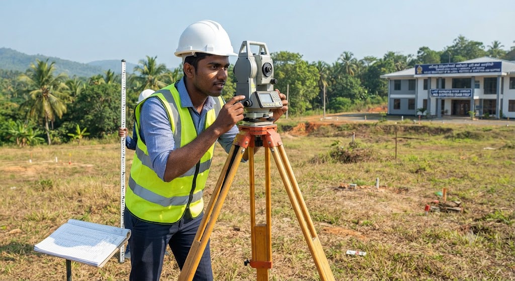
Additional Information
What the Course Entails and Exam Details
The curriculum and subsequent examinations are
comprehensive, designed to test both theoretical knowledge and practical
application. Candidates must demonstrate mastery of several core areas
essential to the practice of surveying in Sri Lanka.
While specific syllabi may vary slightly depending on the
level of certification (e.g., Technical Assistant vs. Licensed Surveyor), the
core subjects generally include:
- Plane
and Geodetic Surveying: Understanding the principles of measuring
distances, angles, and elevations on the earth's surface, accounting for
curvature where necessary.
- Levelling
and Contouring: Mastery of differential levelling, contour mapping,
and interpreting topographical data for engineering projects.
- Theodolite
and Total Station Operations: Practical competency in using optical
and electronic instruments for precise measurements, including traversing
and triangulation.
- GPS
and GNSS Technology: Utilizing Global Navigation Satellite Systems for
modern data collection, control surveys, and georeferencing.
- Cartography
and Plan Drawing: The ability to convert field data into accurate,
professional survey plans and maps according to the standards of the
Survey Department of Sri Lanka.
- Land
Law and Registration: A thorough understanding of the legal framework
governing land ownership, subdivision, and deed registration in Sri Lanka
(e.g., the Registration of Documents Ordinance).
- Subdivision
and Cadastral Surveying: Specific regulations and procedures for
dividing land and defining legal boundaries for title registration.
The exam is structured to rigorously test these skills
through both theoretical papers and practical assessments.
What to Expect in
the Final Exam
The final examination is typically a multi-part process,
ensuring that only fully qualified individuals enter the profession. Candidates
should be prepared for the following components:
- Theory
Papers: These are written examinations consisting of multiple-choice
questions (MCQs), structured questions, and essay-style problems. They
test your understanding of surveying mathematics, instrumentation
principles, legal definitions, and adjustment computations. You will need
to recall formulas, apply surveying principles to hypothetical scenarios,
and demonstrate knowledge of Sri Lankan survey regulations.
- Practical
Examinations (Viva/Field Test): This is often the most challenging
part. You will be taken to a field site and required to perform specific
tasks under the observation of examiners. This may include setting up a
total station over a point, running a precise level loop, conducting a
traverse, or performing a GPS stakeout. Examiners will assess not only the
accuracy of your results but also your field procedures, note-keeping, and
instrument care.
- Plan
Work Examination: Candidates are often required to produce a finished
survey plan from field notes provided during the exam. This tests your
drafting skills, adherence to standard symbols, and ability to accurately
represent the data collected.
Passing Score and Time Limits:
Passing standards are high, reflecting the precision
required in the profession. Typically, a minimum mark (often 50% or 60%) is
required in each individual paper and practical component to pass the
overall examination. Aggregate scores may also be considered. The time limits
for the theory papers are generally strict, requiring candidates to manage
their time effectively between complex calculations and descriptive answers.
Specific rules include the use of approved, non-programmable
calculators and strict adherence to the Survey Department’s code of conduct
during the examination.
How to Study and
Exam Centers
Success in this exam requires a balanced approach combining
rigorous study of theory with extensive hands-on practice.
Actionable Study Strategies:
Master the Fundamentals: Do
not underestimate the importance of basic mathematics (trigonometry, algebra,
geometry) and the principles of error theory. Many exam questions test your
ability to apply these basics in a surveying context.
Hands-On Practice: Theory
alone is insufficient. Spend as much time as possible working with the actual
equipment (Theodolites, Total Stations, Levels, GNSS receivers). Practice
setting up quickly and accurately, and learn how to perform field checks on
your own work (e.g., closing a traverse, checking a level loop).
Review Past Papers: This
is crucial. Obtain past question papers from the Survey Department or
authorized training institutes. Analyze the types of questions asked, the
recurring topics, and the level of detail required in the answers.
Study the Manuals:
Thoroughly read and understand the official survey manuals and circulars issued
by the Survey Department of Sri Lanka. These documents outline the mandatory
procedures and standards for all licensed surveyors.
Join Study Groups: Collaborate
with fellow candidates to discuss complex problems, quiz each other on theory,
and perhaps organize informal practical sessions.
Where and How to Take the Exam:
The examinations are centrally administered by the Survey
Department of Sri Lanka.
- Application
Process: Candidates must typically apply by a set deadline, submitting
proof of educational qualifications, training, and payment of examination
fees. Notifications regarding the exam dates, venues, and index numbers
are sent directly to registered candidates.
- Examination
Centers: Theory examinations are usually held in designated centers in
Colombo and potentially other major regional hubs. Practical and Plan Work
examinations are often conducted at the Institute of Surveying and
Mapping (ISM) in Diyatalawa, or other locations specified by the
Survey Department.
- Accredited
Training: While private study is possible, many candidates benefit
from formal training programs offered by recognized institutions such as
the Institute of Surveying and Mapping (ISM) in Diyatalawa, or other
technical colleges affiliated with the Tertiary and Vocational Education
Commission (TVEC) of Sri Lanka.
Job Opportunities
from the Course
Successfully passing the Land Surveying examinations in Sri
Lanka opens the door to a stable, respected, and financially rewarding career
path. Certification signifies that you are qualified to practice in various
capacities, including:
- Licensed
Surveyor (Private Practice): After obtaining the necessary license,
you can establish your own surveying firm, offering services directly to
the public, legal professionals, and construction companies. This includes
boundary surveys, subdivision plans, and expert witness testimony in land
disputes.
- Surveyor
/ Technical Officer within the Survey Department: Join the government
sector as a public servant, working on national mapping projects,
cadastral surveys, and resource management initiatives across Sri Lanka.
- Engineering
Surveyor (Infrastructure Development): Large-scale construction
projects, such as highways, railways, bridges, and high-rise buildings,
require dedicated engineering surveyors to lay out designs, monitor
structural deformation, and ensure precise construction alignment.
- Hydrographic
Surveyor: With Sri Lanka's focus on port development and coastal
management, hydrographic surveyors are in demand to map the seabed,
monitor coastal erosion, and support maritime navigation.
- GIS
Specialist: Use your surveying knowledge to build and manage
Geographic Information Systems (GIS) for urban planning, environmental
agencies, and utility companies. Your expertise in data capture ensures
the accuracy of the GIS database.
- Lecturer/Instructor:
With experience, you can teach surveying principles at technical colleges,
universities, or training institutes like the ISM, helping to train the
next generation of surveyors.
By dedicating yourself to thorough preparation and mastering
the material outlined in this guide, you can confidently approach the Sri Lanka
Land Surveying Exam and embark on a fulfilling professional career.
Frequently Asked Questions
Reviews
5.0
Based on 0 reviews
Leave a Review
No reviews yet. Be the first to review!