Army Land Navigation/Map Reading Practice Test
About this Exam
Mastering land navigation is a non-negotiable skill for any effective soldier. This practice exam is specifically designed to prepare individuals for the rigors of official Army Land Navigation and Map Reading evaluations. It serves as a vital tool for personnel in Basic Combat Training (BCT), Advanced Individual Training (AIT), the Basic Officer Leader Course (BOLC), and various NCO Professional Development Courses. By simulating the technical and mental demands of finding points in diverse terrain, this practice test builds the competence and confidence required to navigate successfully without relying on electronic GPS devices.
Ready to test your knowledge?
Start now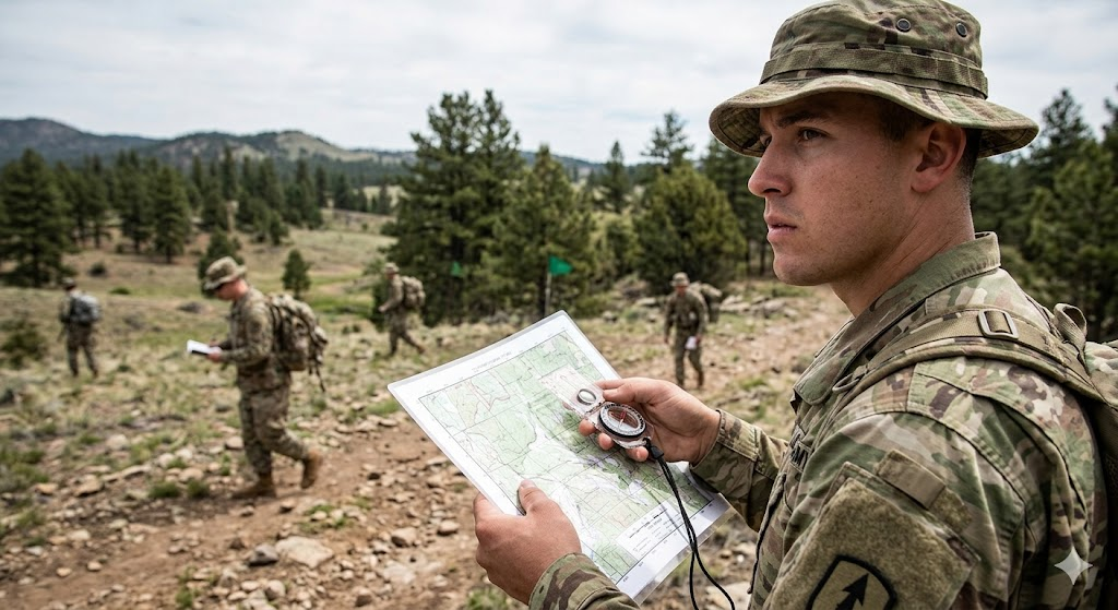
Additional Information
What the Course Entails and Exam Details
This preparation resources focuses on the core pillars of land navigation as outlined in Army training doctrine. Mastery of these subjects is essential to transition from a map reader to a competent navigator.
The key skills and curriculum covered include:
Understanding Map Marginal Information: Comprehensive knowledge of the data found in map margins, including the legend, contour interval, and declination diagram.
Identify Terrain Features: The ability to classify major, minor, and supplementary terrain features (e.g., hills, ridges, valleys, saddles, depressions, draws, spurs, and cliffs) using contour lines.
Grid Reference Systems: Mastering the use of the Military Grid Reference System (MGRS), including plotting and identifying 6-digit, 8-digit, and 10-digit grid coordinates.
Determining Scale and Distance: Using the graphic scale bar to measure distance on a map, accounting for both graphic and statute distance.
Compasses and Azimuths: Becoming proficient in the use of the lensatic compass, including shooting an azimuth, back azimuth, and using techniques like the center-hold and cheek-to-bezel methods.
Navigation Methods: Understanding different methods of navigation, primarily dead reckoning and terrain association.
What to Expect in the Final Exam
While the exact structure may vary by school or unit, official Army Land Navigation exams almost always consist of two primary phases: a written map reading test and a practical field evaluation.
Phase I: Written Map Reading Test
This portion is typically taken in a classroom setting and evaluates your theoretical knowledge before you are allowed to navigate outdoors.
Format: Multiple-choice questions.
Content: Questions will cover marginal information, identifying terrain features from contour lines, plotting grid coordinates, determining back azimuths, and converting between magnetic and grid azimuths using the G-M angle.
Passing Score: Usually requires a minimum of 70% to 80% to proceed to the practical phase.
Phase II: Practical Field Navigation
This is the hands-on verification of your navigation skills.
Format: A practical outdoor course where you must locate specific, numbered points (stakes or signs) in the environment.
Execution: You will receive a set of grid coordinates (start point and multiple endpoints), a map, and a compass. You must navigate to these points individually (though sometimes in buddy teams) within a set time limit.
Time Limit: Deadlines are strictly enforced and vary based on the course length and difficulty (e.g., finding 3 out of 4 points within 4 hours). There are often separate daytime and nighttime evaluations.
Rules: No GPS or electronic navigation aids are permitted. Cheating or following other students results in immediate failure. You must physically record the code found at each checkpoint.
How to Study and Exam Centers
Preparation for land navigation must combine both cognitive study and practical, physical application. Do not rely solely on books.
Effective Study Strategies
Use the Army Land Navigation Practice Exam: Take practice tests repeatedly to refine your speed and accuracy in plotting grids and determining azimuths. Simulate the pressure of the 4-hour time limit.
Master the G-M Angle: Practice converting from map (grid) azimuth to compass (magnetic) azimuth using the declination diagram until it is second nature. "Left ADD, Right SUBTRACT" (from grid) is a common mnemonic.
Physical Practice (Pace Count): You must establish an accurate pace count. Practice walking exactly 100 meters on a measured course with all your gear (ACH, FLC, ruck) to know how many steps you take. Re-verify this in different terrain types (flat vs. hilly).
Practice in the Field: If possible, practice at a local orienteering course or utilize available military training areas. Practice finding known grid locations in daylight before attempting night navigation.
Where to Take the Exam
You do not schedule this exam individually through commercial vendors like Pearson VUE. The Army Land Navigation and Map Reading tests are administered exclusively within the military. You will take the exam as a mandatory component of:
Initial Entry Training: Basic Combat Training (BCT) or One Station Unit Training (OSUT).
Officer Accession Programs: OCS, ROTC Advanced Camp, or BOLC.
NCO Professional Development System (NCOPDS): Courses such as the Basic Leader Course (BLC) and Advanced Leader Course (ALC).
Specialized Schools: Pre-Ranger Course, Ranger School, and Special Forces Assessment and Selection (SFAS).
Job Opportunities from the Course
A high level of proficiency in land navigation is a foundational requirement for military leadership and specialized roles. Exceptional skill can lead to selection for premier military schools and units.
This certification/skill proficiency unlocks career paths such as:
Army Ranger (upon completion of Ranger School)
Special Forces (Green Beret) Operator
Infantry Officer or NCO
Reconnaissance Platoon Leader or Scout
Cavalry Scout
Pathfinder
Warrant Officer (many technical tracks require demonstrated leadership and basic soldier skills)
Sapper
Frequently Asked Questions
Reviews
5.0
Based on 0 reviews
Leave a Review
No reviews yet. Be the first to review!